On-Greenland’s-icy-edge,-where-silence-usually-reigns,-a-mysterious-seismic-heartbeat-began-pulsing-through-Earth’s-crust.-Instruments-from-Alaska-to-Australia-picked-it-up-—a-slow,-rhythmic-signal-that-puzzled-scientists-for-nine-days.-It-wasn’t-a-normal-earthquake.-It-wasn’t-a-man-made-explosion.-What-it-was…-turned-out-to-be-far-more-extraordinary.
In September 2023, a massive chunk of mountain collapsed into Greenland’s Dickson Fjord, generating a 650-foot mega-tsunami. While the colossal wave caused destruction locally, the lingering motion it triggered—an unusual “sloshing” called a seiche—sent seismic echoes around the world.
This article dives into how this Arctic landslide created a chain reaction of global proportions, and why this event could redefine how we monitor Earth’s most remote and dynamic environments.
Table of Contents
🌍 A Mysterious Global Pulse
On September 16, 2023, a signal began quietly rippling through the planet. Every 92 seconds, seismic stations recorded smooth, repeating waves—unlike any typical earthquake. These waves lasted nine days, bouncing steadily through the crust.
The culprit? A landslide-triggered tsunami in a secluded fjord in eastern Greenland.
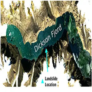
Fresh satellite images revealed a gaping scar on a mountainside in Dickson Fjord, where over 25 million cubic yards of rock and ice—the equivalent of 10,000 Olympic swimming pools—had fallen into the narrow waterway. The resulting impact sent a towering wave hurtling down the fjord.
🌊 The Birth of a Mega-Tsunami
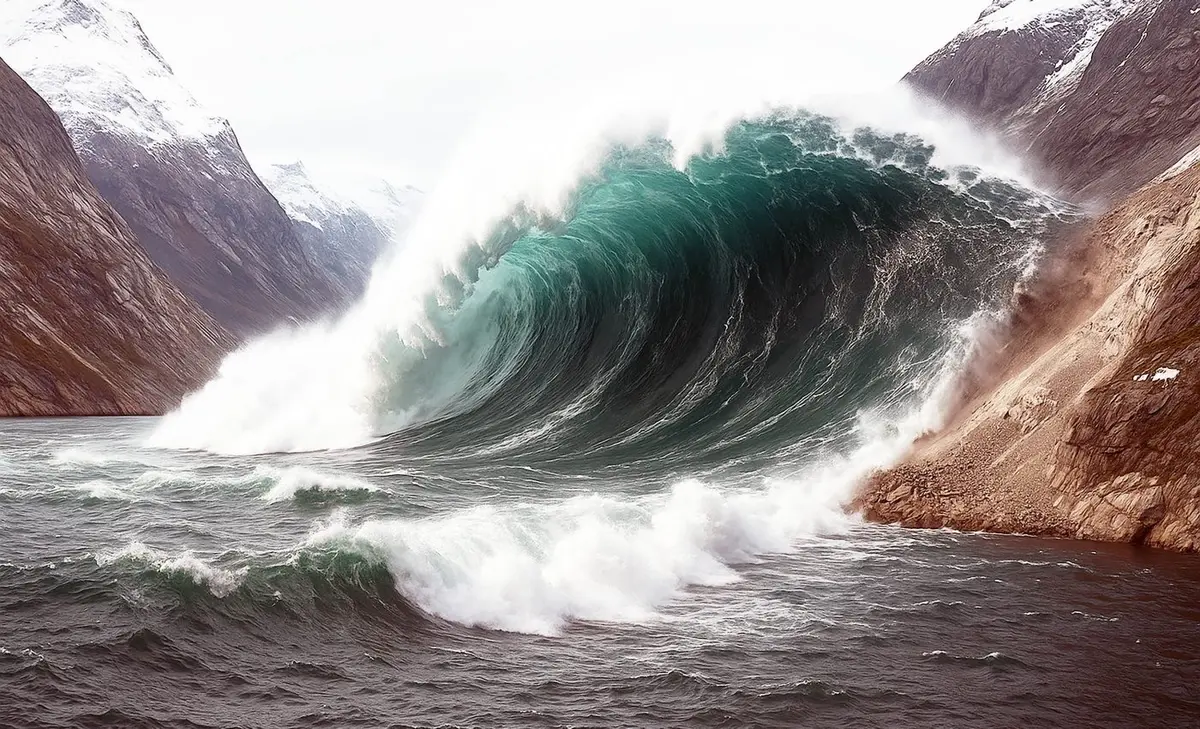
This was no ordinary wave. The impact launched a 650-foot high tsunami—nearly twice the height of the Statue of Liberty.
The wave charged through the two-mile-long fjord, slammed into cliffs, and ricocheted back. Even though no civilians were in the path, $200,000 worth of research equipment on Ella Island was destroyed. But that was just the beginning.
Instead of settling, the water began to rock back and forth repeatedly—a phenomenon known as a seiche. Think of a bathtub wave that never dies out.
📊 Seiche vs. Tsunami: What’s the Difference?
To understand what happened, let’s break down the two types of waves at play.
| Feature | Tsunami | Seiche |
|---|---|---|
| Cause | Sudden displacement (e.g., earthquake, landslide) | Oscillation from external force (e.g., wind, landslide) |
| Wave Type | Outward-propagating waves | Standing waves within a contained body |
| Duration | Minutes to hours | Can last days or weeks |
| Locations | Oceans, coastal zones | Lakes, harbors, fjords |
| Seismic Impact | Brief, intense seismic signal | Prolonged, rhythmic seismic pulses |
| Example | Indian Ocean Tsunami (2004) | Dickson Fjord (2023), Lake Geneva (563 AD) |
This combination of a mega-tsunami and a long-lasting seiche made the Dickson Fjord event unique in the scientific record.
🧪 Cracking the Case: A Scientific Collaboration
Over 70 researchers from 41 institutions worked together to analyze the event. Using-Copernicus-Sentinel-2-satellite-imagery-and-advanced-computer-simulations,-they-retraced-the-rockfall’s-path-and-how-it-triggered-the-fjord’s-dynamic-response.
Some simulations estimated that the sloshing motion lifted the fjord’s surface up to 30 feet—equivalent to a three-story building.
“We had no idea what this was at first,” said geologist Kristian Svennevig. “Only with a truly interdisciplinary and global effort were we able to solve the puzzle.”
🔭 Satellite Tech Reveals the Invisible
New satellite technology played a vital role. The Surface Water and Ocean Topography (SWOT) mission, launched in December 2022, offered breakthrough imagery. Unlike earlier satellites that scanned narrow lines, SWOT maps 30-mile swaths with 8-foot resolution.
These images captured how the fjord’s surface rose and fell days after the initial landslide, confirming the presence of the persistent seiche.
“This kind of event was nearly invisible a decade ago,” said Oxford University’s Thomas Monahan. “Now, we can measure it in near real time.”
🔥 The Climate Connection
Why did the landslide happen in the first place? According to scientists, the cliff face was once buttressed by glacial ice. As-Arctic-temperatures-rise,-that-natural-brace-is-disappearing.
“Climate change is quietly setting up new disaster scenarios,” noted tsunami researcher Alice Gabriel. “As ice recedes, slopes become unstable.”
This isn’t the first incident. In 2017, a similar landslide in Karrat Fjord killed four people and destroyed homes. With cruise ships increasingly navigating Arctic routes, authorities are now reviewing early-warning systems that combine satellite feeds with real-time seismic alerts.

📉 Why This Event Matters
- Global seismic detection: Seiches can register on earthquake sensors. Differentiating between them is key to early-warning accuracy.
- Remote doesn’t mean irrelevant: Even uninhabited zones can cause worldwide effects.
- Climate-wake-up-call:-As-the-Arctic-warms,-landslide-triggered-tsunamis-may-become-more-common.
- Satellite synergy: Advanced Earth observation tools are changing how we monitor and respond to hidden disasters.
“We’re only beginning to understand the complex relationship between geology, water, and climate,” said Professor Thomas Adcock. “And tools like SWOT and AI are critical to the future of this science.”
🧠 Lessons from the Arctic’s Seismic Pulse
The Dickson Fjord event underscores one truth: Even in the quietest corners of our planet, Earth has stories to tell. The 650-foot mega-tsunami wasn’t just a local disaster—it was a planet-wide pulse, a reminder that climate, geology, and water are all interconnected.
Researchers are now combing through global seismic archives to look for similar slow pulses. Each new finding helps refine models and improve disaster response systems for fjord regions, mountain lakes, and other enclosed waters at risk.